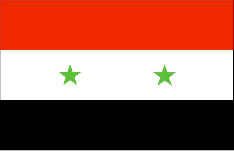
Country Guide • Syria

The country can be divided into four regions: the coastal strip in the west (on the east coast of the Mediterranean, between Turkey in the north and Lebanon in the south); two narrow mountain ranges (just in from the coast and along the Lebanese border); the fertile plains (around Damascus, Homs, Hama and Aleppo); and the hot, dry deserts (to the south east). Syria is located in the Middle East. It is bound by the Mediterranean Sea and Lebanon to the west, Israel and Jordan to the south west, Iraq to the east and Turkey to the north.
| Official Name | Syrian Arab Republic |
|---|---|
| Area | 185,180km² (71,498mile²) |
| Population | 17,585,540 |
| Continent | Middle East |
| Population per mile² | 246 |
| Capital City | Damascus |
| Religions | The official religion is Islam: 74% Sunni Muslims, 16% Alawaites, Ismailis or Shiite Muslims. 9% Christians the remainder are Druze |
| Language | Arabic (official), Kurdish, Armenian, Aramaic, Circassian widely understood; French, English somewhat understood |
| Government | Military republic |
| Currency | Syrian Pound |
| GDP | $59.4 billion |
| GDP per Head | $3,500 |
| Natural Resources | Petroleum, phosphates, chrome and manganese ores, asphalt, iron ore, rock salt, marble, gypsum, hydropower |
| Land Use | Arable Land 26% |
| Agriculture | Barley, wheat, cotton, lentils, chickpeas, olives, sugar beets; beef, mutton, eggs, poultry, milk |
| Industry | Petroleum, textiles, food processing, beverages, tobacco, phosphate rock mining |
| Tourism | Syria is home to some of the best ruins in the world. For those interested in ancient history and the culture of the Middle East, it's an absolute treasure trove. And with a government eager to attract both independent and group travelers, the country is constantly improving its infrastructure and amenities. In major tourist areas, small, clean hotels are opening up alongside luxury establishments. Transportation is well organised and comfortable |
| Natural Hazards | Dust storms, sandstorms |
| Health Risks | It is wise to consider vaccinations for polio, tetanus, typhoid and hepatitis A and B |
| Climate | Syria has a Mediterranean climate which is characterised by hot, dry summers and fairly cold winters. Nights are often cool. The coolest month is January and the hottest are July and August. Average annual rainfall is 12 inches but varies from region to region. Average temperature ranges in Damascus are from 0 to 12°C in January to 18 to 37°C in August |
| Time | GMT/UTC+2 hours |
| National Days | April 17 Independence Day |
| Visas | You require a visa for Syria. Whether or not you have a visa you should be aware that if your passport contains an Israeli stamp or stamps from other countries’ border crossing points with Israel, you will be refused entry to Syria. If you intend staying for more than fifteen days you will need to have your visa extended at the immigration office, otherwise you may face difficulties when trying to leave the country |
| British Embassy | Embassy Details |
Information Only
The content above is for information purposes only and we have tried to ensure that the information is as accurate as possible. We cannot accept any responsibility for any inconvenience, loss or injury as a result of the information above. You should always check and verify any critical information like visas, health and safety and customs with the relevant authorities before you travel since information can change at any time.


