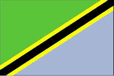
Country Guide • Tanzania

The United Republic of Tanzania lies on the east coast of Africa and is bordered by Kenya and Uganda to the north; by Burundi, Rwanda and the Democratic Republic of Congo to the west; by the Indian Ocean to the east; and by Zambia, Malawi and Mozambique to the south.
| Official Name | United Republic of Tanzania |
|---|---|
| Area | 939,361km² (362,689mile²) |
| Population | 35,922,454 |
| Continent | Africa |
| Population per mile² | 98 |
| Capital City | Dodoma |
| Religions | Mainland - Christian 30%, Muslim 35%, indigenous beliefs 35%; Zanzibar - more than 99% Muslim |
| Language | Kiswahili or Swahili (official), Kiunguju (name for Swahili in Zanzibar), English (official, primary language of commerce, administration, and higher education), Arabic (widely spoken in Zanzibar), many local languages |
| Government | Republic (multi-party state) |
| Currency | Tanzanian Shilling |
| GDP | $22.5 billion |
| GDP per Head | $630 |
| Natural Resources | Hydropower, tin, phosphates, iron ore, coal, diamonds, gemstones, gold, natural gas, nickel |
| Land Use | Arable Land 4.24% |
| Agriculture | Bananas, cashew Nuts, cassava (tapioca), cloves (Zanzibar), coffee, corn, sisal, tea, cotton, pyrethrum (insecticide made from chrysanthemums), tobacco, wheat, fruits, vegetables, livestock inc. cattle, sheep and goats |
| Industry | Agricultural processing (sugar, beer, cigarettes, sisal twine), diamond and gold mining, oil refining, shoes, cement, textiles, wood products, fertilizer and salt |
| Tourism | The most developed, but unspoilt, Tanzanian tourist route is the Northern circuit which encompasses many of the parks and reserves in Northern Tanzania. The circuit includes many famous national parks and landmarks: • Serengeti National Park• Ngorongoro Conservation Area • Mount Kilimanjaro Africa's highest mountain. In the south of Tanzania lie some of the most untouched game reserves in Africa: • Selous Game Reserve. Remote and wild, the Selous is the largest game reserve in Africa. The Rufiji River flows through the reserve attracting great herds of Tanzania elephant and allowing the visitor to experience the reserve by boat. The reserve has the largest number of elephants out of all the reserved wildlife areas in the country. It also has a wide variety of other animals including lion, wild dog and crocodiles. To the North and the South of Dar es Salaam lie miles upon miles of pristine Indian Ocean Coastline |
| Natural Hazards | Flooding on the central plateau during the rainy season; drought |
| Health Risks | Yellow fever, malaria, bilharzia, tsetse fly, cholera, hepatitis, meningitis, typhoid and HIV/AIDS |
| Climate | Tanzania has a tropical equatorial climate modified by altitude. The north has two distinct wet seasons with the longest from March - May and the shortest from November - December while the rest of the country has one wet season from November - May. Around 50% of the country receives an annual rainfall of approx. 30 inches rising to a maximum of 100 inches at Lake Nyasa. Average temperature ranges in Dar-es-Salaam are from 19 - 31°C throughout the year |
| Time | GMT/UTC+3 hours |
| National Days | December 9 - Independence and Republic Day |
| Visas | Visitors to Tanzania and Zanzibar should ensure that they have a valid passport and visa. Visas can be obtained at Tanzanian diplomatic missions or on arrival at the airport. Zanzibar operates its own immigration control and visitors require a valid Yellow Fever certificate. Although Yellow Fever vaccination certificates are no longer needed on mainland Tanzania, visitors should still be vaccinated against this disease |
| British Embassy | Embassy Details |
Information Only
The content above is for information purposes only and we have tried to ensure that the information is as accurate as possible. We cannot accept any responsibility for any inconvenience, loss or injury as a result of the information above. You should always check and verify any critical information like visas, health and safety and customs with the relevant authorities before you travel since information can change at any time.


